


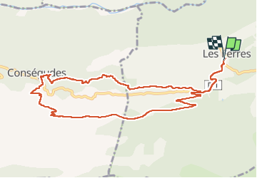
boucle les Ferres - Consegudes - canal de Vigay

franquen
User

Length
12.1 km

Max alt
850 m

Uphill gradient
447 m
Km-Effort
18.1 km

Min alt
471 m

Downhill gradient
440 m
Boucle
Yes
Creation date :
2024-11-07 08:13:21.94
Updated on :
2024-11-07 16:08:23.859
5h53
Difficulty : Easy

FREE GPS app for hiking
 SityTrail
IGN / Geographical institutes
SityTrail Plus
The world is yours!
About
Trail Walking of 12.1 km to be discovered at Provence-Alpes-Côte d'Azur, Maritime Alps, Les Ferres. This trail is proposed by franquen.
Positioning
Country:
France
Region :
Provence-Alpes-Côte d'Azur
Department/Province :
Maritime Alps
Municipality :
Les Ferres
Location:
Unknown
Start:(Dec)
Start:(UTM)
346693 ; 4856506 (32T) N.
Comments